© 2011 Pearson Education, Inc. Landscapes Fashioned by Water Chapter 3.
57
© 2011 Pearson Education, Inc. Landscapes Fashioned by Water Chapter 3
-
Upload
gwen-hodge -
Category
Documents
-
view
215 -
download
2
Transcript of © 2011 Pearson Education, Inc. Landscapes Fashioned by Water Chapter 3.

© 2011 Pearson Education, Inc.
Landscapes Fashioned by WaterChapter 3

© 2011 Pearson Education, Inc.
Weathering, mass wasting, and erosion are all called external processes
• Occur at or near the Earth’s surface• Powered by energy from the Sun
Weathering- the physical breakdown and chemical alteration of rock Mass wasting- the transfer of rock and soil downslope by gravityErosion- the physical removal of material by water, waves, wind, or ice
Earth’s external processes
© 2011 Pearson Education, Inc.
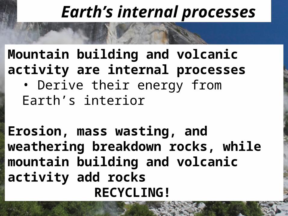
Mountain building and volcanic activity are internal processes
• Derive their energy from Earth’s interior
Erosion, mass wasting, and weathering breakdown rocks, while mountain building and volcanic activity add rocks
RECYCLING!
Earth’s internal processes

© 2011 Pearson Education, Inc.
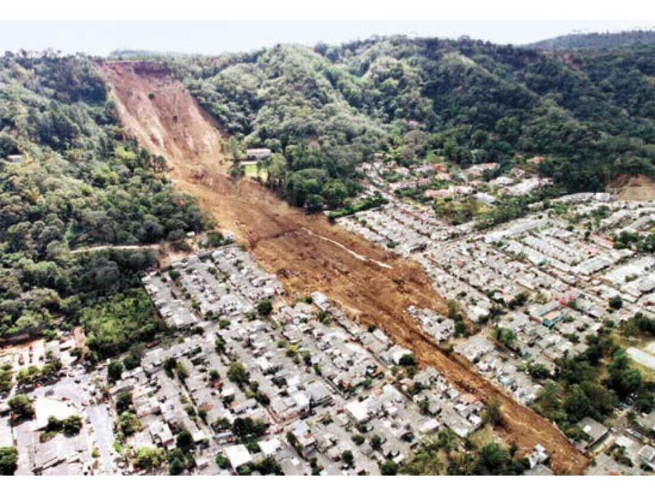
Mass wasting is the downslope movement of rock and soil due to gravity
• Causes loss of life and property (USGS- 25 to 50 people killed annually in the U.S.)• Natural disasters•Different from erosional processes - does not require a transporting medium (H2O, wind, glaciers, etc.)• Follows after weathering in the evolution of landforms
© 2011 Pearson Education, Inc.

© 2011 Pearson Education, Inc.
First the rocks weather….
Then they get mass wasted…..
Then carried out by the river

© 2011 Pearson Education, Inc.
Types of mass-wasting
Debris Flow
© 2011 Pearson Education, Inc.
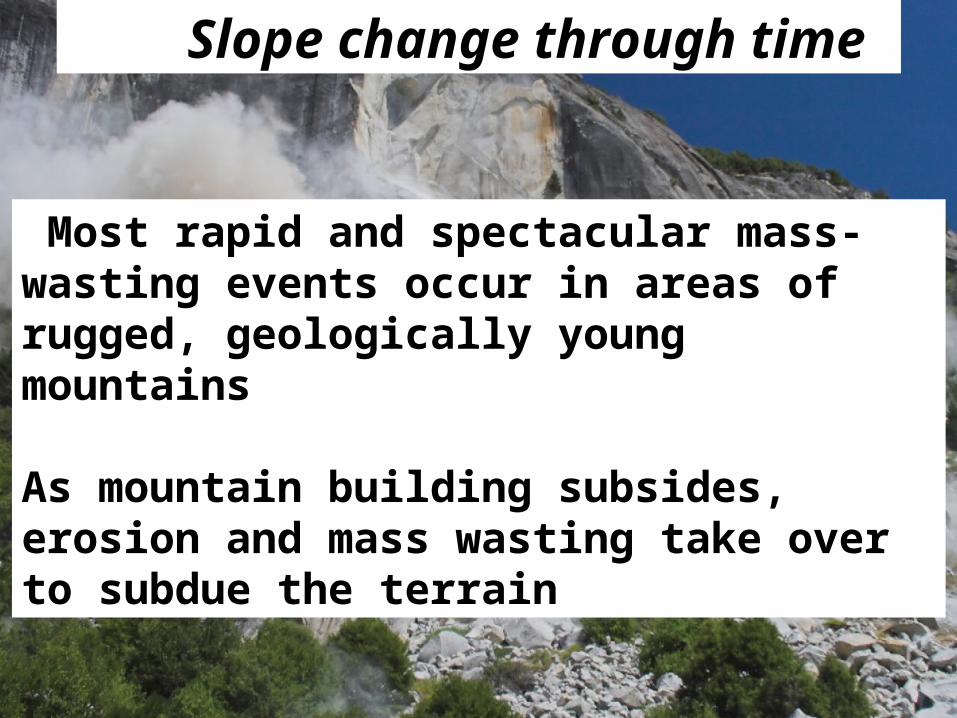
Most rapid and spectacular mass-wasting events occur in areas of rugged, geologically young mountains
As mountain building subsides, erosion and mass wasting take over to subdue the terrain
Slope change through time

© 2011 Pearson Education, Inc.

© 2011 Pearson Education, Inc.
Gravity is the controlling force of mass wasting and does not require a trigger to start, but sometimes it doesExamples of triggers
• Water• Oversteepening of slope• Removal of vegetation• Earthquakes

© 2011 Pearson Education, Inc.
Water• Heavy rains or snow melt• Pores in sediment become filled, cohesion is lost• Added weight

© 2011 Pearson Education, Inc.
Oversteepened Slopes• A stream under cutting a valley wall, or waves pounding against the base of a cliff • Angle of repose (25 to 40 degrees), steepest angle at which unconsolidated sediments will remain stable
© 2011 Pearson Education, Inc.
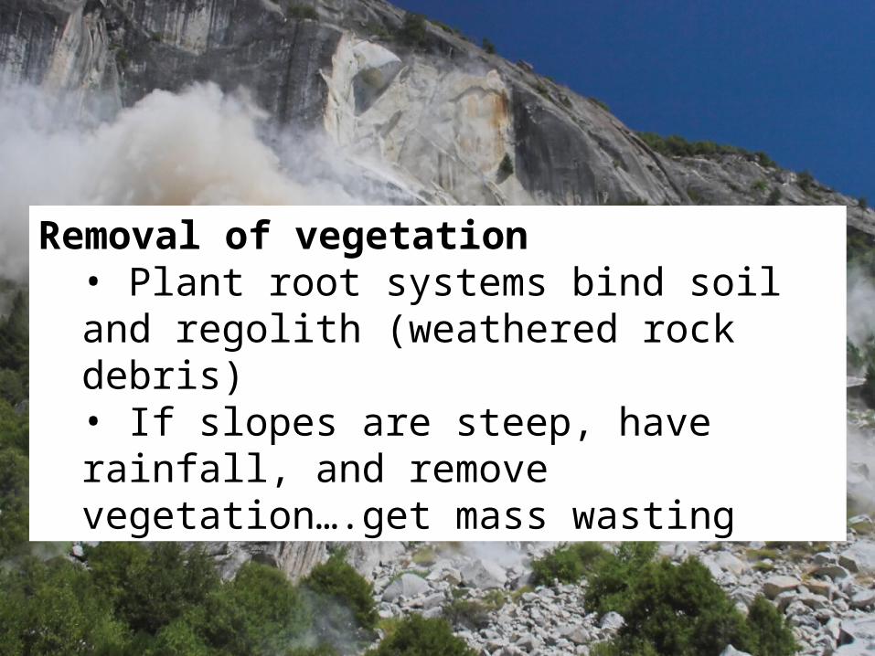
Removal of vegetation• Plant root systems bind soil and regolith (weathered rock debris)• If slopes are steep, have rainfall, and remove vegetation….get mass wasting

© 2011 Pearson Education, Inc.
Earthquakes• Most dramatic mass wasting trigger• Dislodge enormous volumes of rocks and unconsolidated material• Liquefication- unconsolidated, saturated sediments are turned into a “liquid”

© 2011 Pearson Education, Inc.
Salmon Beach landslide area, near Tacoma, Washington, after the 2001 Nisqually earthquake. Puget Sound is in the fore-ground

© 2011 Pearson Education, Inc.
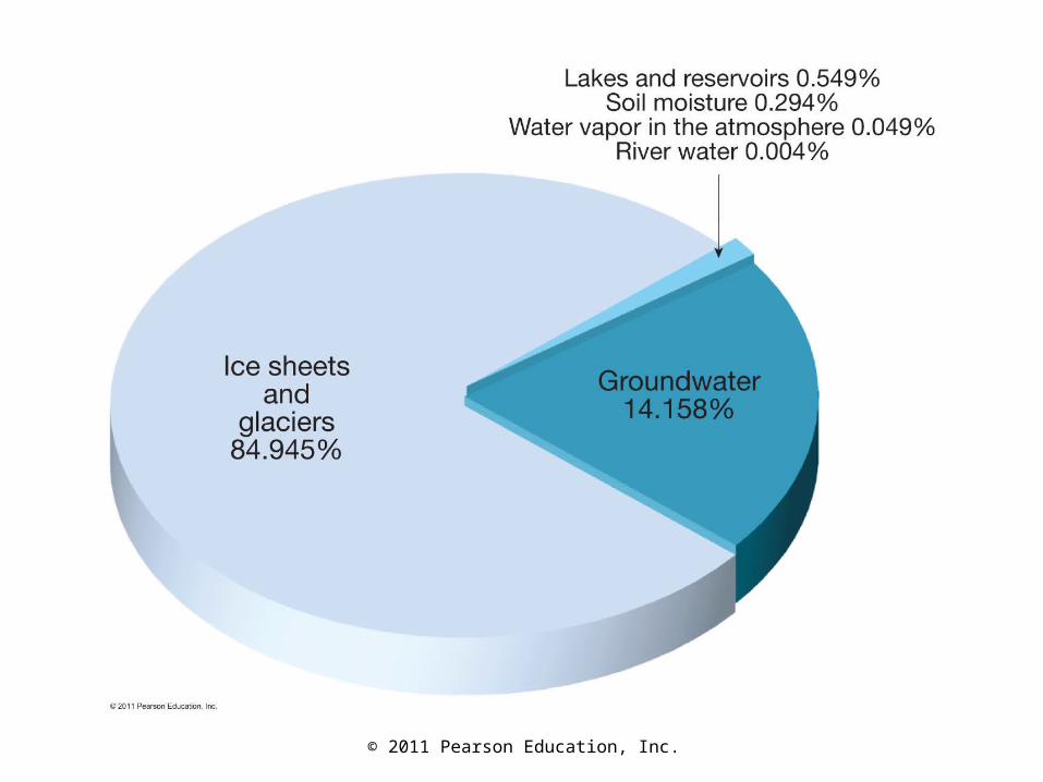
• The Earth’s hydrosphere– Water content is about 1.36 billion km3 (326
million miles3)– 97% in oceans, 2% ice and glaciers, and 1% in
lakes, streams, groundwater, and atmosphere
Water Cycle
© 2011 Pearson Education, Inc.
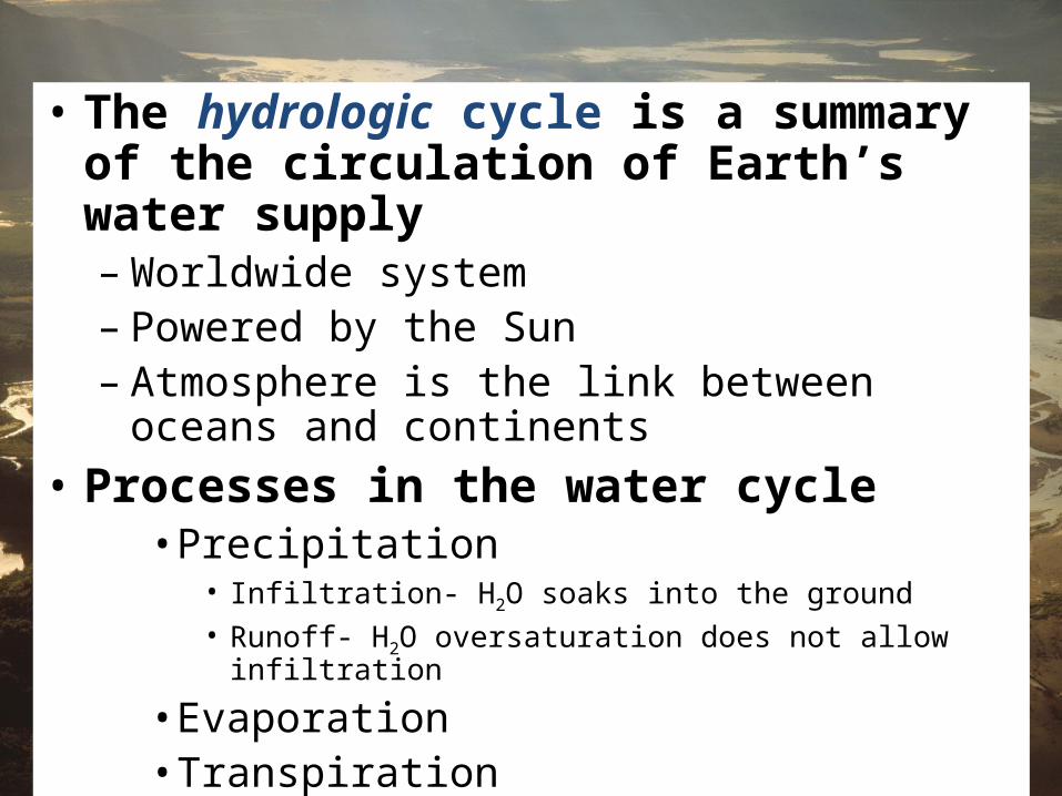
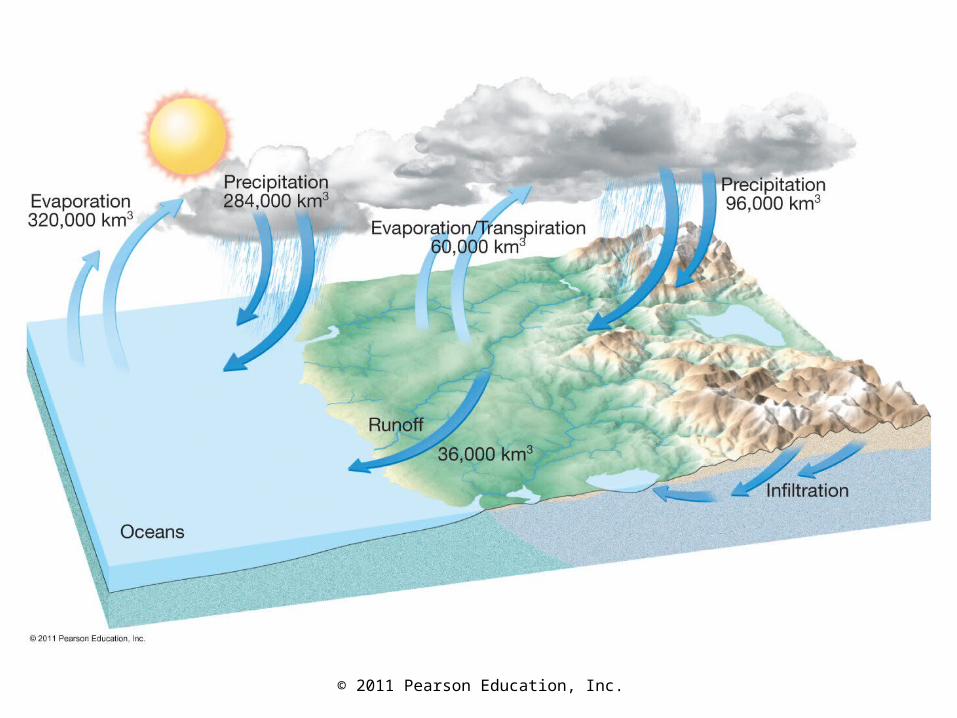
• The hydrologic cycle is a summary of the circulation of Earth’s water supply– Worldwide system– Powered by the Sun– Atmosphere is the link between oceans and
continents
• Processes in the water cycle• Precipitation
• Infiltration- H2O soaks into the ground• Runoff- H2O oversaturation does not allow infiltration
• Evaporation• Transpiration

© 2011 Pearson Education, Inc.
• The water cycle is balanced– Total amount of H2O vapor in the atmosphere remains
the same– Average annual precipitation worldwide must be equal to
the quantity of water evaporated– Evaporation over the continents is exceeded by
precipitation– Precipitation over the oceans is exceeded by
evaporation
© 2011 Pearson Education, Inc.

© 2011 Pearson Education, Inc.
Running waterSurface Water
• If water is not infiltrated, it becomes runoff. The amount of runoff depends on• Intensity and duration of rainfall• Amount of water already in the soil• Nature of the soil or material• Slope of the land• Extent of vegetation
• Is runoff high or low in urban areas?
© 2011 Pearson Education, Inc.
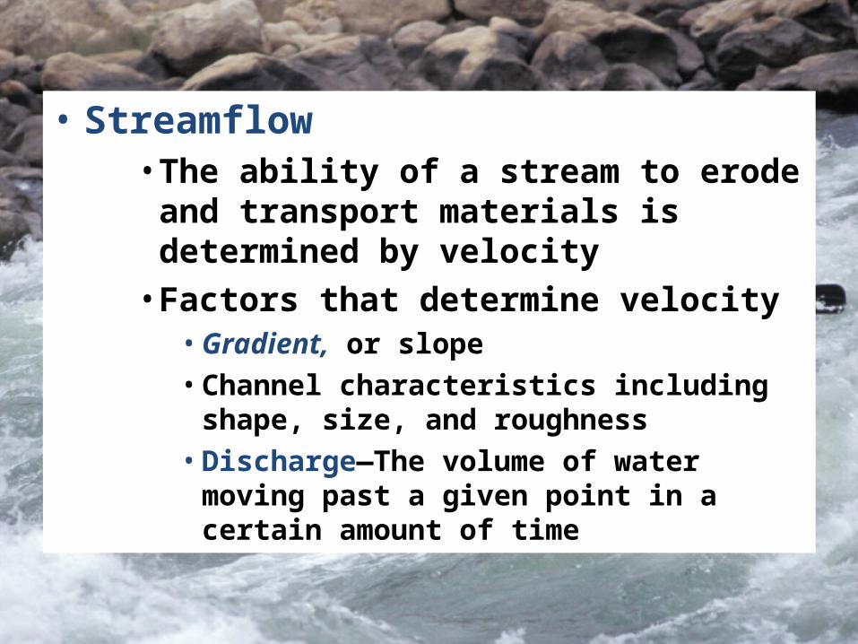
• Streamflow• The ability of a stream to erode and
transport materials is determined by velocity
• Factors that determine velocity• Gradient, or slope• Channel characteristics including shape,
size, and roughness• Discharge—The volume of water moving
past a given point in a certain amount of time

© 2011 Pearson Education, Inc.
• Changes along a stream• Cross-sectional view of a stream is
called the profile• Viewed from the head (headwaters or
source) to the mouth of a stream
• Changes from upstream to downstream• Profile
• Profile is a smooth curve• Gradient decreases downstream
• Factors that increase downstream• Velocity• Discharge• Channel size

© 2011 Pearson Education, Inc.
Longitudinal profile of California’s Kings River

© 2011 Pearson Education, Inc.
• Base level and stream erosion• Base level is the lowest point to which a
stream can erode• Two general types of base level
• Ultimate (sea level)• Local or temporary
• Changing conditions causes readjustment of stream activities
• Raising base level causes deposition• Lowering base level causes erosion
Base Level

© 2011 Pearson Education, Inc.
Adjustment of base level to changing conditions

© 2011 Pearson Education, Inc.
• Stream erosion• Lifting loosely consolidated particles by
• Abrasion• Dissolution
• Stronger currents lift particles more effectively
The work of streams

© 2011 Pearson Education, Inc.
• Transport of sediment by streams• Transported material is called the
stream’s load• Types of load
• Dissolved load• Suspended load• Bed load
• Capacity—the maximum load a stream can transport
• Competence
• Indicates the maximum particle size a stream can transport
• Determined by the stream’s velocity

© 2011 Pearson Education, Inc.
• Deposition of sediment by a stream• Caused by a decrease in velocity
• Competence is reduced• Sediment begins to drop out
• Stream sediments• Generally well sorted• Stream sediments are known as alluvium

© 2011 Pearson Education, Inc.
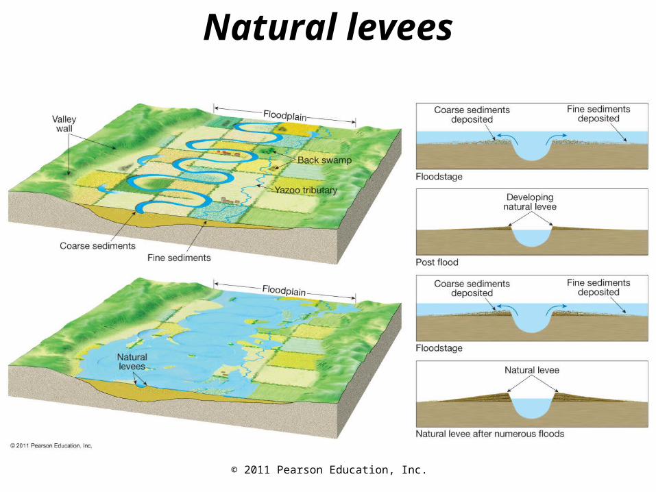
• Deposition of sediment by a stream• Delta—Body of sediment where a stream
enters a lake or the ocean• Results from a sudden decrease in velocity
• Natural levees—Form parallel to the stream channel by successive floods over many years
• Floodplain deposits• Back swamps• Yazoo tributaries

© 2011 Pearson Education, Inc.
Structure of a simple delta
© 2011 Pearson Education, Inc.
Natural levees
© 2011 Pearson Education, Inc.
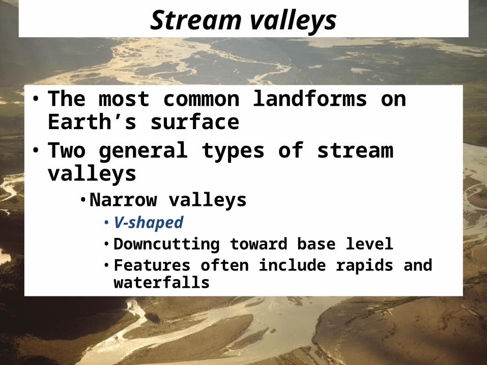
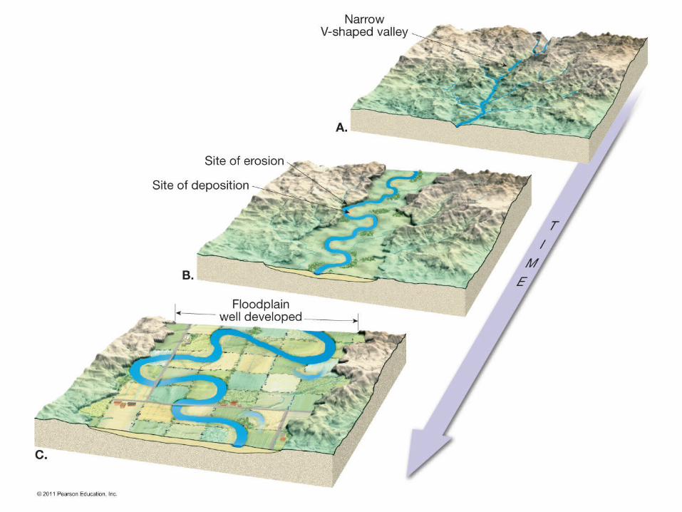
Stream valleys
• The most common landforms on Earth’s surface
• Two general types of stream valleys• Narrow valleys
• V-shaped • Downcutting toward base level• Features often include rapids and waterfalls

© 2011 Pearson Education, Inc.

© 2011 Pearson Education, Inc.
• Two general types of stream valleys• Wide valleys
• Stream is near base level• Downward erosion is less dominant• Stream energy is directed from side to side
forming a floodplain
© 2011 Pearson Education, Inc.

© 2011 Pearson Education, Inc.
• Features of wide valleys often include• Floodplains
• Depositional floodplains• Meanders• Cut banks and point bars• Cutoffs and oxbow lakes

© 2011 Pearson Education, Inc.

© 2011 Pearson Education, Inc.
Drainage basins and patterns
• Drainage networks• Land area that contributes water to the
stream is the drainage basin• Imaginary line separating one basin
from another is called a divide

© 2011 Pearson Education, Inc.
© 2011 Pearson Education, Inc.
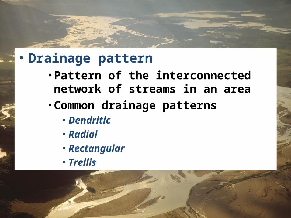
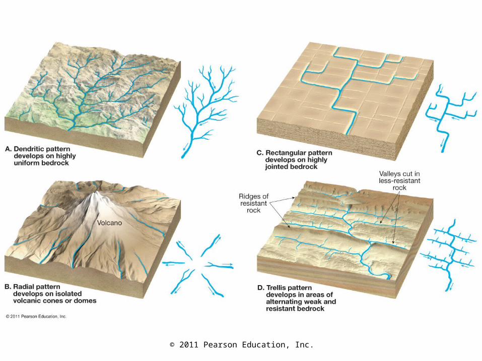
• Drainage pattern• Pattern of the interconnected network of
streams in an area• Common drainage patterns
• Dendritic• Radial• Rectangular• Trellis
© 2011 Pearson Education, Inc.

© 2011 Pearson Education, Inc.
Floods and flood control
• Floods and flood control• Floods are the most common and most
destructive geologic hazard• Causes of flooding
• Result from naturally occurring and human-induced factors
• Causes include heavy rains, rapid snow melt, dam failure, topography, and surface conditions

© 2011 Pearson Education, Inc.
Water beneath the surfaceGroundwater
• Largest freshwater reservoir for humans
• Geological roles• As an erosional agent, dissolving by
groundwater produces• Sinkholes• Caverns
• An equalizer of stream flow
© 2011 Pearson Education, Inc.

© 2011 Pearson Education, Inc.
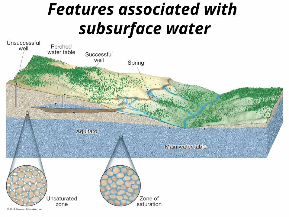
• Distribution and movement of groundwater• Distribution of groundwater
• Belt of soil moisture• Zone of aeration
• Unsaturated zone• Pore spaces in the material are filled
mainly with air• Zone of saturation
• All pore spaces in the material are filled with water
• Water within the pores is groundwater• Water table — The upper limit of the zone of
saturation
© 2011 Pearson Education, Inc.
Features associated with subsurface water

© 2011 Pearson Education, Inc.
• Movement of groundwater• Porosity
• Percentage of pore spaces• Determines how much groundwater can be
stored
• Permeability• Ability to transmit water through connected
pores• Aquitard — An impermeable layer of
material• Aquifer — A permeable layer of material
© 2011 Pearson Education, Inc.
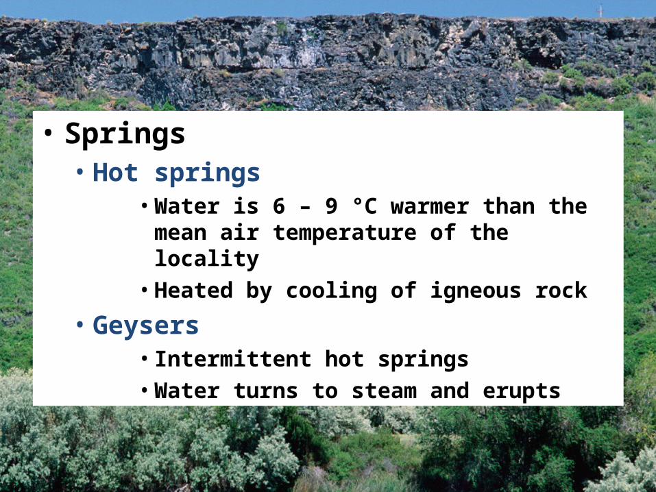
• Springs• Hot springs
• Water is 6 – 9 °C warmer than the mean air temperature of the locality
• Heated by cooling of igneous rock
• Geysers• Intermittent hot springs• Water turns to steam and erupts

© 2011 Pearson Education, Inc.
Video 1Video 2

© 2011 Pearson Education, Inc.
• Wells• Pumping can cause a drawdown (lowering)
of the water table• Pumping can form a cone of depression in
the water table
• Artesian wells• Water in the well rises higher than the
initial groundwater level • Artesian wells act as “natural pipelines”
moving water from remote areas of recharge great distances to the points of discharge

© 2011 Pearson Education, Inc.
Formation of a cone of depression

© 2011 Pearson Education, Inc.
An artesian well resulting from an inclined aquifer

© 2011 Pearson Education, Inc.
• Environmental problems associated with groundwater• Treating it as a nonrenewable resource • Land subsidence caused by its withdrawal
• Sinkholes
• Contamination
© 2011 Pearson Education, Inc.
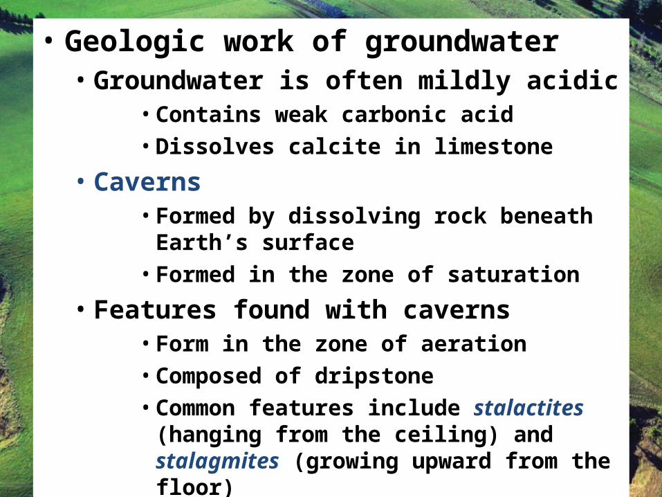
• Geologic work of groundwater• Groundwater is often mildly acidic
• Contains weak carbonic acid• Dissolves calcite in limestone
• Caverns• Formed by dissolving rock beneath Earth’s
surface• Formed in the zone of saturation
• Features found with caverns• Form in the zone of aeration• Composed of dripstone• Common features include stalactites
(hanging from the ceiling) and stalagmites (growing upward from the floor)

© 2011 Pearson Education, Inc.
Carlsbad Caverns National Park
© 2011 Pearson Education, Inc.
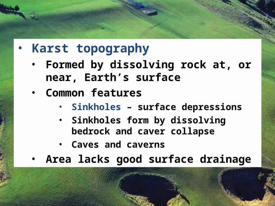
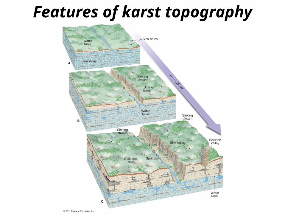
• Karst topography• Formed by dissolving rock at, or near,
Earth’s surface• Common features
• Sinkholes – surface depressions• Sinkholes form by dissolving bedrock and
caver collapse• Caves and caverns
• Area lacks good surface drainage
© 2011 Pearson Education, Inc.
Features of karst topography